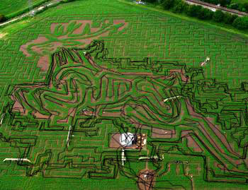
 rollover image
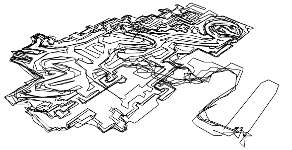
Headless Stag
With 17.6 miles of paths over 6.157 Acres the maze was designed with two sub-mazes
allowing three levels of difficulty.
The final and most complicated level was not open when we arrived to the site,
so we were left drawing a headless stag.
Location: [N50°
44' 47.2" W1° 44' 29.4"] Stewarts GardenLands, Christchurch,
Dorset, UK
Time: 12/05/02 (16:08:10-17:15:09)
Track Length: 8.6 km
Average speed: 5.4 kph
Method: On foot
Credits: Hugh Pryor & Jeremy Wood
GPSograph_ Shockwave Viewer
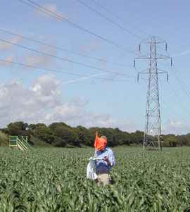
On a windy day the 'Help' flags are not very helpful.