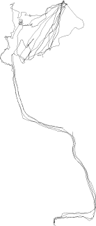
Hickling
Drift
Location: Norfolk Broads
Total Time: 15:39:31-18:01:12 [16/08/03]
Total Track Length: 9.28km
Method: Explorer 200 inflatable boats
Credits: Hugh Pryor & Jeremy
Wood with one boat and one GPS receiver each

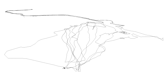
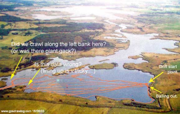
We ventured out onto the Norfolk Broads with two inflatable boats
and modest means of propulsion.
We paddled upwind to an open area and then starting from approximately the same
point we recorded our drift back.
The GPS tracks seen above and below amount to 01:33:33 hours of drifting, each
time for about 200-250
metres at an average speed of 1.1 kph, and one of us was slightly aided by wearing
a large brimmed hat in the light wind.

Below is a full map our paddle starting from the Thurne and then
left along Meadow Dyke
and along to the southern end of Heigham Sound where
we mostly drifted about.