GPS Drawing [Gallery] [Maps] [About]
TRAVERSE ME
Warwick campus map [A4 Map] [Photographs] [Free Map] [Limited Edition Print]
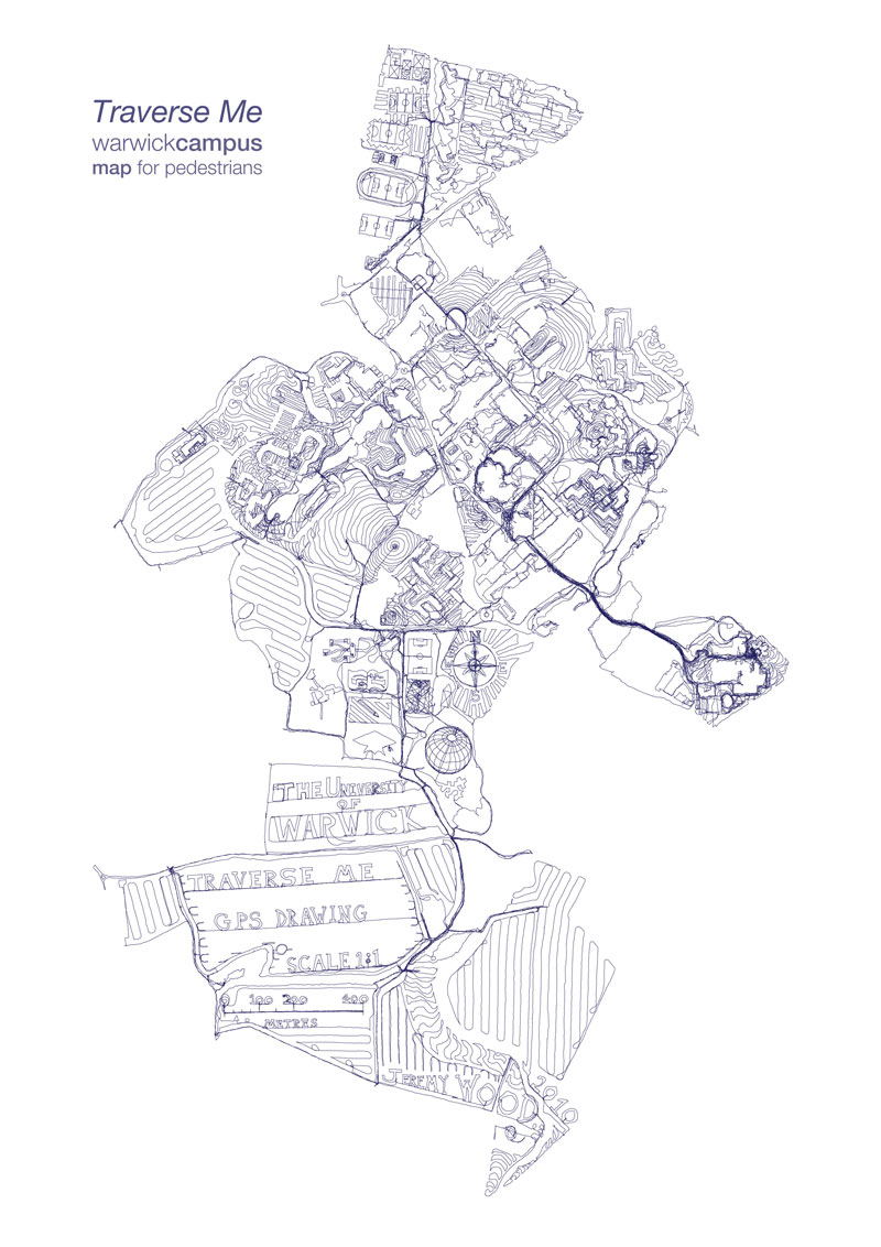
The University of Warwick campus
map was drawn on foot at 1:1 scale with 238 miles of GPS tracks walked over 17 days
1:5 000 Scale 20"x30" Limited Edition Prints are available for £95 from the Mead Gallery
Traverse Me is a map drawn by walking across campus with a GPS device to invite the viewer to see a different landscape to that which surrounds them.
It questions the possibilities of where they are and inspires a personal reading of their movements and explorations of the campus.

Traverse Me Backside Photo map (more...)
I responded to the structure of each location and avoided walking along roads and paths when possible.
The route was recorded with GPS technology and was walked in stages over the 300 hectare site.
My shoes turned brown in the dry fields and they turned green in the long grass.
The compass rose and the globe were paced out over cricket pitches, and the scale was measured along a narrow tractor rut.
I collided with objects and buildings, barriers and footpaths, and traipsed over the tops of multi-story car parks.
Security was called on me twice on separate occasions and I lost count of how many times I happened to trigger an automatic sliding door.


Traverse Me with aerial images

Traverse Me Blue 1:5 000 scale screen print


Natural Path, Unatural Path, and GPS Gate
Commissioned by the 
Jeremy Wood.
06/2010
www.gpsdrawing.com